
Check flood conditions in your area every day
RP Map brings together data from GISTDA, HII, the Royal Irrigation Department, and Bangkok Metropolitan Administration (BMA) on one map. Free to use, with no sign-up.
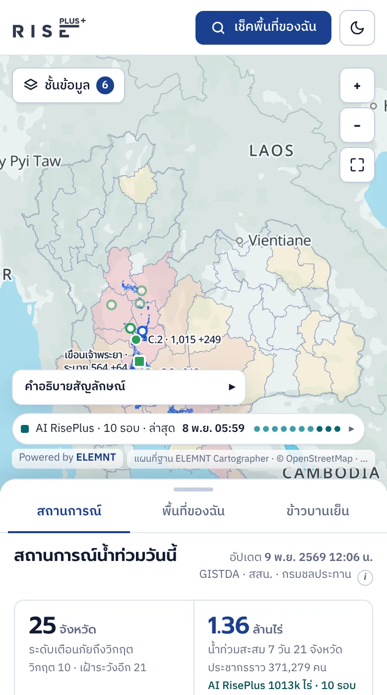
Multiple data layers, one map
Provincial conditions, satellite imagery, rain radar, flood areas, water levels and incident reports. Toggle each layer on or off as needed.
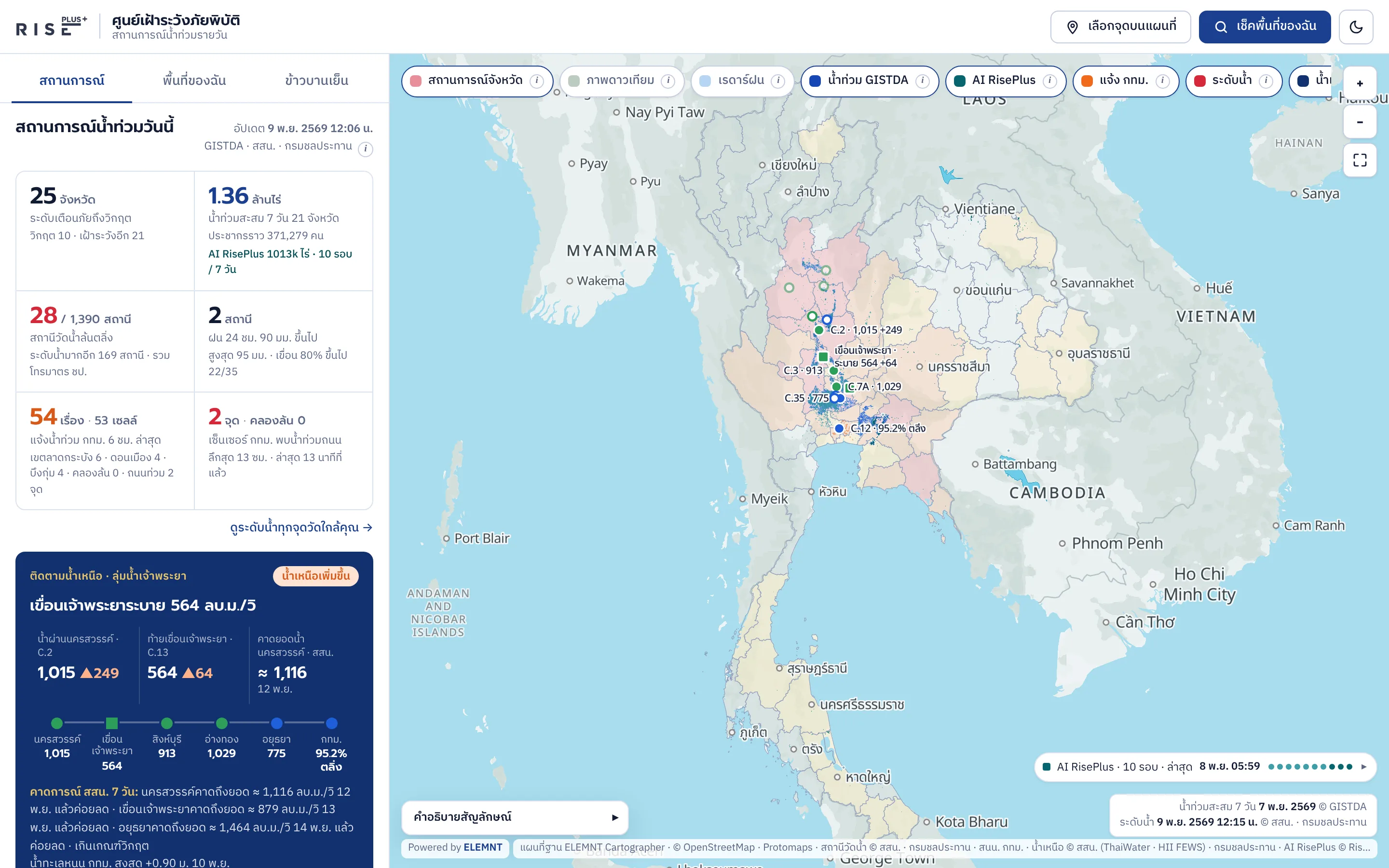
- Sources
- GISTDA, HII, Royal Irrigation Department, Bangkok Metropolitan Administration (BMA)
- Refresh
- Daily
- Access
- Free to use, no sign-up
What you can check on RP Map
- My area
- Use your current location or tap a point on the map to check conditions there
- Floods from satellites
- Data from GISTDA and AI RisePlus, processed by the Data team using a foundation model
- Water level by station
- Water levels from stations, bank-overflow points, accumulated rainfall, and reservoirs
- Track upstream water
- Upstream water and water in the Chao Phraya basin, with forecasts from HII
- Bangkok flood reports
- Reports from Traffy Fondue and Bangkok Metropolitan Administration (BMA) road sensors
- Emergency hotlines
- Department of Disaster Prevention and Mitigation (DDPM) 1784, Royal Irrigation Department 1460, and Emergency Medical Services 1669
Behind RP Map
Start with open data
Government data is the foundation; each layer identifies its source and update time
Automatic updates
The system retrieves and processes data on schedule, so no manual uploads are needed
Not an evacuation instruction
This map is for monitoring. Always follow announcements from local authorities
Built on PMTiles, GeoParquet, H3, OGC API, and MapLibre
Data points the way.
RP Map helps identify areas in need, providing information to support deliveries of Baan Yen Rice.
Rice reaches the hands.
Bring RP Map to your organization
We adapt RP Map to your area and your organization's data, starting with a prototype built on real data.